Agriculture
June 13, 2024
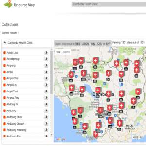
Resource Map
Read SolutionImplemented by
Resource Map
Updated on June 13, 2024
·Created on September 9, 2017
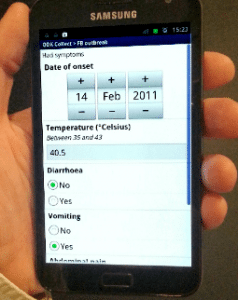
Poimapper is a mobile data collection and management application.
Poimapper is a mobile data collection and management application that allows the user to geotag mobile data collection and visualize data in real time. Its main application areas are industrial inspection, mapping, retail execution, market research, environmental services, rural healthcare & development program monitoring. Poimapper works across device categories, from tablets to smartphones.
Target SDGs
SDG 16: Peace, Justice and Strong Institutions
SDG 8: Decent Work and Economic Growth
Target Users (Target Impact Group)
Public Sector Agencies, NGOs
Distributors / Implementing Organizations
Poimapper's most relevant implementers can be found here. The list includes the following NGOs: Plan International, WWF Green Office, Tearfund and CARE (Philippines).
Competitive Landscape
Direct competitors include Field Papers, Ushahidi, Epicollect5, Magpi, Open Data Kit, and Akvo Flow.
Regions
Worldwide
Manufacturing/Building Method
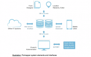
Poimapper is a cloud based application with both SQL and non-SQL databases on the back end. It is an HTLM5 web application for the front end with applications for Android and iOS.
Intellectural Property Type
Patent
User Provision Model
All forms of provision can be found here, special conditions apply to NGOs and academic institutions.
Distributions to Date Status
Over 120 countries in over 2000 projects
Google Play Store reports over 5,000 installs of the Android application
Geocoding supported (Y/N)
Yes
Visuals
Maps, tables, charts
Application
Mobile data collection, monitoring and evaluation, surveys, impact evaluations
Type of data collected
Survey/data input, multimedia (photos, audio, or video), geolocation
Data acquisition methods
Mobile data collection
Open source code (Y/N)
No
Open source data (Y /N/ Other)
No
Data import/export formats
CSV, XLSX, DOCX, KML, SPSS, ARCGIS
Telecommunication service required (Y/N)
Mobile data or WiFi/landline connection for offline collection and synchronization
Device(s) required
Smartphone, feature phone, computer or tablet
Languages available (list)
English, Suomi, French
Design Specifications
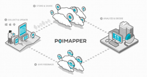
Poimapper combines its mobile app with the back end cloud service to provide remote workers the ability to collect data or provide care in remote areas with little to no cellular service. Custom data forms allow organizations to collect the data that they require and validate it. It also allows remote workers to send feedback from the field.
Product Schematics
Technical Support
Email support included in the Light version. Full support is included in Pro version.
Replacement Components
N/A
Lifecycle
N/A
Manufacturer Specified Performance Parameters
To improve reliability, accuracy, and visualization of mobile data collection for development organizations.
Vetted Performance Status
According to the Plan International report, Plan Thailand estimates that Poimapper has saved around 3 days per month for the health volunteers and 2 days per month for their field officers. That translates to about 3,000 USD per year in staff costs. Plan Bangladesh calculated that they would save 20,000 USD per year in printing and labor costs. Plan Thailand also states that they have been able to work 30% faster and provide greater visibility to management and donors.
Safety
N/A
Complementary Technical Systems
Excel, SPSS, ArcGIS or Highcharts
Academic Research and References
Kotovirta, V., Toivanen, T., Tergujeff, R., Häme, T., Molinier, M., 2015, Citizen Science For Earth Observation: Applications In Environmental Monitoring And Disaster Response, ISPRS – International Archives of the Photogrammetry, Remote Sensing and Spatial Information Sciences
Moss, M., 2012, Collecting and utilizing point-of-interest (POI) data cost-effectively with mobile technologies. Proceedings of the 2012 Mechanical Engineering Conference on Sustainable Research and Innovation
Mwakumanya, M., Mwachupa, J., 2018, Digital mapping as a tool for environmental and social corporate accountability in the extractive sector in Kwale County, Kenya, Journal of Sustainable Mining, Volume 17, Issue 3, Pages 97-104, ISSN 2300-3960
Kotovirta, V., Toivanen, T., Tergujeff, R., Häme, T., Molinier, M. , 2015, Citizen science for earth observation: Applications in environmental monitoring and disaster response, The International Archives of the Photogrammetry, Remote Sensing and Spatial Information Sciences, Volume XL-7/W3, 36th International Symposium on Remote Sensing of Environment, 11–15 May 2015, Berlin, Germany
“Customers.” 2021. POIMAPPER. November 25, 2021. https://www.poimapper.com/customers/
“Pricing.” 2021. POIMAPPER. November 25, 2021. https://www.poimapper.com/pricing/
“Goal 16.” n.d. Sdgs.Un.Org. Accessed June 13, 2024. https://sdgs.un.org/goals/goal16
“Poimapper Plus.” n.d. Google.Com. Accessed June 13, 2024. https://play.google.com/store/apps/details?id=com.pajat.poimapper&hl=en
“?Poimapper Plus.” n.d. App Store. Accessed June 13, 2024. https://apps.apple.com/us/app/poimapper-plus/id657692208
“Terms of Service – Poimapper.” n.d. Poimapper.Com. Accessed June 13, 2024. https://portal.poimapper.com/termofservice.jsp
“Produkt.” 2022. POIMAPPER. June 27, 2022. https://www.poimapper.com/sv/product/
Packington, Prepared by Erica, and Hannah Beardon. n.d. “A Review of Current Practice and Lessons Learned.” Ictworks.Org. Accessed June 13, 2024. https://www.ictworks.org/wp-content/uploads/2016/03/Digital-Data-Collection-Plan.pdf
Haddad, Ryan, Tim Kelly, Teemu Leinonen, and Vesa Saarinen. n.d. “Using Locational Data from Mobile Phones to Enhance the Science of Delivery.” Worldbank.Org. Accessed June 13, 2024. https://documents1.worldbank.org/curated/en/687441468313509206/pdf/ACS96440REVISE0very00final0Digital0.pdf
Compliance with regulations
Poimapper is in compliance with all local and international privacy laws according to their terms of service.
Evaluation methods
Field trials as described in World Banks’s report on information and communication technologies.
Agriculture
June 13, 2024
Implemented by
Resource Map
Agriculture
June 13, 2024
Implemented by
Esri
Agriculture
December 11, 2024
Implemented by
Ambros Huber

Agriculture
June 26, 2024
Implemented by
CGNet Swara
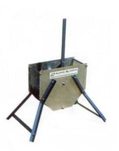
Agriculture
September 11, 2024
Implemented by
Alvan Blanch
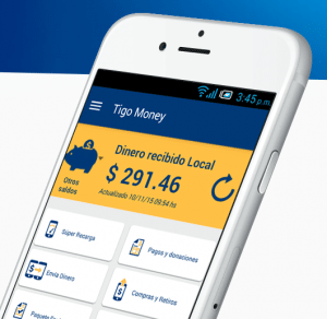
Agriculture
June 26, 2024
Implemented by
Millicom International Cellular
Agriculture
June 4, 2024
Implemented by
University of Washington
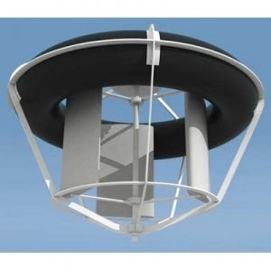
Agriculture
December 2, 2024
Implemented by
Mobile Hydro
Agriculture
June 25, 2024
Implemented by
SeeClickFix

Agriculture
June 5, 2024
Implemented by
Simprints
Have thoughts on how we can improve?
Give Us Feedback