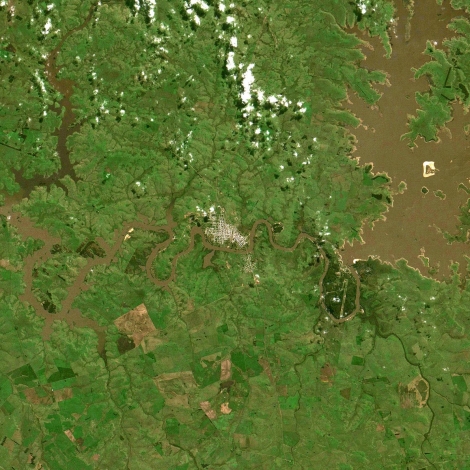
A solution to ease some of the pressure to produce food as the world’s population climbs may be the combination of two technologies, satellite data and machine learning. Neither technology is new, but they are each evolving into more powerful and more ubiquitous tools than they ever were before.
As satellite data becomes more accessible and cost effective, it is allowing access to data that wouldn’t have been available to most governments just 25 years ago. In the past it would have taken specialists weeks or months to analyze the data and publish the reports. Now you can train machine learning algorithms that analyze the data at unprecedented speeds and publish data sets and maps within hours of receiving the data.
As the technologies continue to mature and the cost barriers are lowered, we are entering the ‘Data Revolution’ for agriculture.
There are several public datasets that are freely available, such as NASA’s LANCE and ESA’s Earth Online. There are a growing number of private companies with their own constellations of satellites providing near real time data, such as Digital Globe, Planet and Satellogic. As commercial entities are driving the current space race, we’re quickly approaching the commoditization of launch vehicles and satellite hardware.
Machine learning is very good at image processing and classification, making it an ideal fit for processing satellite imagery. Several private companies are attempting to become the data intermediaries and are developing massive datasets and APIs that increase accessibility and usefulness. Two leaders in the agricultural intelligence movement are aWhere and EOS Data Analytics. They each presented their work this month at conferences in Washington, DC (USA), aWhere at FHI 360’s ICTforAg and EOS at Amazon Web Services Public Sector Summit.
Also at E4C: Ten ICTs Connecting Farmers to the World
Both companies are combining public and private datasets and using machine learning algorithms that can determine crop type, health, pests and monitor crop production rates by season. These datasets are updated at a much higher frequency than traditional crop monitoring and reporting and they produce critical insights to make input decisions.
As costs continue to drop and we apply these technologies to small holder farmers, they could determine early predictors to address food security issues before they develop. You could have a near real time response to drought, disease, and lack of inputs, and communicate this to the farmers while they can still address the issues. Working with local governments and NGOs, they could provide training and utilize this information to supplement and enhance current agricultural development programs.
Also at E4C: Hello Tractor’s Business-Saving Pivot from Hardware to Software
This kind of innovation will become increasingly important. Most of E4C’s reader base is probably aware that the world’s population is projected to reach 9.6 billion by 2050. In order to feed over 9 billion people, we will need increase food production by roughly 70 percent. Unless we allow further deforestation, we will need to dramatically increase yields. But we need to have sustainability in mind to avoid erosion, soil degradation and run-off pollution. As we reach the limits of the Green Revolution we need to find new technologies and techniques to make up this large deficit in food production.
Some of that work is already underway. Farmers are combining IoT devices and drone imagery with satellite data to create hyper local profiles of farms at a resolution and frequency not possible just a few years ago. Precision agriculture and automation with cloud-based analytics is the future of farming. As the technologies continue to mature and the cost barriers are lowered, we are entering the Data Revolution for agriculture. We will need all of these advances and more in order to meet the needs of the future.


great topic to be involved in. am an electrical engineer in africa…this is a game changer