Agriculture
June 20, 2024
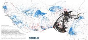
Flowminder
Read SolutionImplemented by
Flowminder
Updated on June 13, 2024
·Created on September 10, 2017
Mapbox is an online mapping platform designed for interaction with mobile and web applications
Mapbox offers a set of tools aimed at map integration in an application or website. Mapbox provides custom online maps, as well as an open API and its documentation.
Target SDGs
SDG 16: Peace, Justice and Strong Institutions
Target Users (Target Impact Group)
Small and Medium-sized Enterprises, Public Sector Agencies, NGOs
Distributors / Implementing Organizations
Mapbox, Ushahidi, Catholic Charities, The World Bank, United Nations Development Program
Regions
Worldwide
Manufacturing/Building Method
Software development
Intellectural Property Type
Copyright
User Provision Model
There are several options, starting at a free use license. Full list of services provided can be found here
Distributions to Date Status
Mapbox is used by 150,000 active developers each month, taking part in more than 45,000 apps, and reaching over 600 million active users.
Geocoding supported (Y/N)
Yes
Visuals
Maps, charts, heat maps, layers
Application
Resource and project management, disaster response, impact evaluations, market research, disease mapping, app development
Type of data collected
Text, numbers, multimedia (photos, video, audio, etc), location
Data acquisition methods
Mobile app data collection, crowd sourced data, remote sensing, government census data
Open source code (Y/N)
No
Open source data (Y /N/ Other)
The majority of Mapbox’s data is publicly available, but they do work with proprietary data sets that they cannot publish
Data import/export formats
Mapbox supports CSV, GeoJSON, MBTiles, KML, GPX, Shapefile, and GeoTiff
Telecommunication service required (Y/N)
Mobile or landline internet
Device(s) required
Smartphone, feature phone, computer, or tablet
Languages available (list)
Languages available: English, Spanish, French, German, Russian, Chinese, Simplified Chinese, Portuguese, and Arabic
Design Specifications
Mapbox provides a detailed overview of how to interact with map data SDKs and their APIs. It also allows the possibility of integrating visualizations into the maps, providing customization of maps with data sets that organizations collect. Mapbox is active in the Open Street Map and Humanitarian Open Street Map development communities.
Technical Support
Support is provided by Mapbox as a part of the subscription.
Replacement Components
N/A
Lifecycle
Major update releases every 1-2 years.
Manufacturer Specified Performance Parameters
To enable developers to focus on application design by providing technical solutions to map and location integration such as SDK and APIs. More specifically to humanitarian response, Mapbox is committed to providing the data, imagery and services to help support disaster response.
Vetted Performance Status
UNDP has used Mapbox to track over 4,000 projects in 151 countries, in 2020. On the other hand, Mapbox reports that, every month, over 150,000 developers integrate Mapbox's services with their projects.
Safety
N/A
Complementary Technical Systems
Mobile data collection applications
Academic Research and References
Eriksson, O., Rydkvist, E., 2015, An in-depth analysis of dynamically rendered vector-based maps with WebGL using Mapbox GL JS (Dissertation)
Cadenas, C., 2014, Geovisualization: Integration and Visualization of Multiple Datasets Using Mapbox, California Polytechnic State University – San Luis Obispo
Austin, D., Bailey, H., Christopher, J., 2017, Adding Vector Data to Mapbox Studio, GIS and Mapping Task Sheets
“Mapbox.” n.d. Mapbox.Com. Accessed June 13, 2024. https://www.mapbox.com/
“Mapbox Pricing.” n.d. Mapbox.Com. Accessed June 13, 2024. https://www.mapbox.com/pricing
“Google Maps.” n.d. Google Maps. Accessed June 13, 2024. https://maps.google.com/
“Bing Maps.” n.d. Bing Maps. Accessed June 13, 2024. https://www.bing.com/maps
“Maps.” n.d. Apple. Accessed June 13, 2024. https://www.apple.com/maps/
“Goal 16.” n.d. Sdgs.Un.Org. Accessed June 13, 2024. https://sdgs.un.org/goals/goal16
“Upload Data To.” n.d. Mapbox. Accessed June 13, 2024. https://docs.mapbox.com/help/troubleshooting/uploads/
“Change Your Map’s Label Language.” n.d. Mapbox. Accessed June 13, 2024. https://docs.mapbox.com/help/troubleshooting/change-language/
“Getting Started.” n.d. Mapbox. Accessed June 13, 2024. https://docs.mapbox.com/help/getting-started/
“Data Visualization.” n.d. Mapbox.Com. Accessed June 13, 2024. https://www.mapbox.com/use-cases/data-visualization
“Humanitarian OpenStreetMap Team.” n.d. Humanitarian OpenStreetMap Team. Accessed June 13, 2024. https://www.hotosm.org/
“Support Services: Resources & Pricing Plans.” n.d. Mapbox.Com. Accessed June 13, 2024. https://www.mapbox.com/support
“Community.” n.d. Mapbox.Com. Accessed June 13, 2024. https://www.mapbox.com/community
“UNDP Transparency Portal.” n.d. UNDP Transparency Portal. Accessed June 13, 2024. https://open.undp.org/#2017
“Filling the Gaps: MapGive Imagery Services Enhance Humanitarian Mapping.” n.d. ReliefWeb. Accessed June 13, 2024. https://reliefweb.int/report/world/filling-gaps-mapgive-imagery-services-enhance-humanitarian-mapping
“UNDP and Grandata Join Forces in a Tool for Addressing Public Policy Decision Supported on Data.” n.d. UNDP. Accessed June 13, 2024. https://www.latinamerica.undp.org/content/rblac/en/home/presscenter/pressreleases/2020/undp-and-grandata-join-forces-in-a-tool-for-addressing-public-po.html
“Legal Information about Terms of Service.” n.d. Mapbox.Com. Accessed June 13, 2024. https://www.mapbox.com/legal/tos
Compliance with regulations
According to their Terms of Service Mapbox is in compliance with all local laws and regulations
Evaluation methods
Integration of Mapbox’s services in multiple platforms (applications/websites)
Agriculture
June 20, 2024
Implemented by
Flowminder
Agriculture
June 25, 2024
Implemented by
MIMU

Agriculture
June 25, 2024
Implemented by
Media in Cooperation and Transition (MiCT)

Agriculture
June 20, 2024
Implemented by
Premise
Agriculture
June 25, 2024
Implemented by
SeeClickFix

Agriculture
June 24, 2024
Implemented by
UNICEF
Agriculture
June 25, 2024
Implemented by
PublicStuff

Agriculture
June 26, 2024
Implemented by
Digicel
Agriculture
June 13, 2024
Implemented by
Esri
Agriculture
June 24, 2024
Implemented by
Map Kibera
Have thoughts on how we can improve?
Give Us Feedback