Agriculture
January 17, 2024
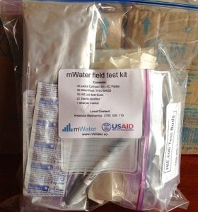
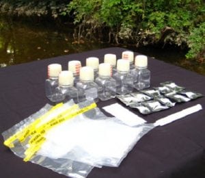
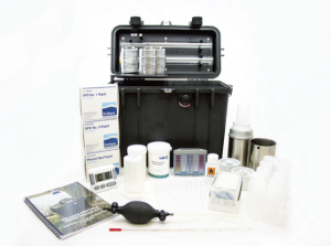
mWater Field Test Kit
Read SolutionImplemented by
mWater
Updated on June 24, 2024
·Created on August 27, 2015
mWater is an application to map water sources and sanitation facilities.
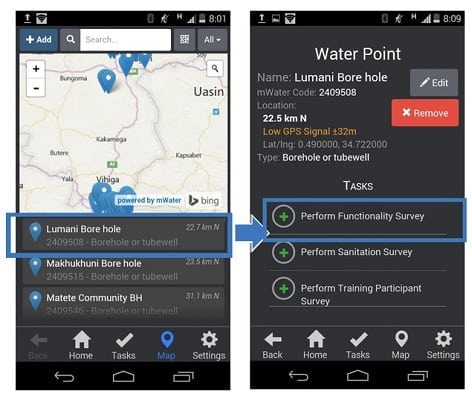
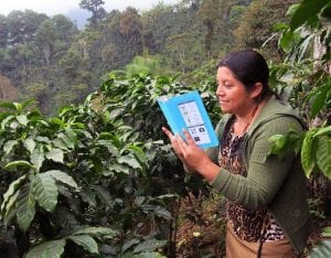
The mWater Explorer Mobile App allows users to map water sources and sanitation facilities and report functionality, water quality, or sanitary inspection reports using standard forms. The App allows the user to test a water source, take a picture of the results, and upload them to an online database for other users to see and use. The app uses GPS to show the location of the uploaded information, and broadcasts it onto a global map available within the application itself.
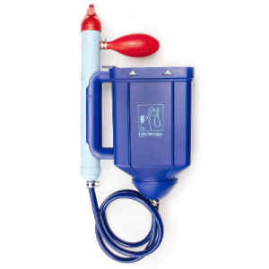
The mWater App is integrated with the mWater test kit – a single-use water quality test kit.
Target SDGs
SDG 6: Clean Water and Sanitation
SDG 3: Good Health and Well-Being
Market Suggested Retail Price
$100,000.00
Target Users (Target Impact Group)
Household, Community
Distributors / Implementing Organizations
mWater
Regions
Worldwide
Manufacturing/Building Method
N/A
Intellectural Property Type
Copyright
User Provision Model
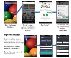
The mWater Explorer App is available for free in a browser version, Android version and iOS version. Users can request custom services.
Distributions to Date Status
Over 40,000 mWater free users worldwide
Mobile service required
Mobile Internet
Device(s) required
Smartphone or/and tablet/computer
Additional features required
GPS
Permanent network connectivity required (Y/N)
No
Two way communication (Y/N)
No
Usage rate (%)
Over 40,000 free users worldwide
Literacy support
Yes
Languages available
Available in 17 languages
Operating system and version
Android 4.4 or superior and iOS 9.0 or above
mWater application
Data collection & analytics, surveying, monitoring & evaluation, mapping
Design Specifications
The mWater Explorer App is a lightweight app that allows users to upload data such as photos of water quality tests (5 MP autofocus camera minimum) via standard forms that can be linked to water points or sanitation facilities using their phone’s GPS to identify the exact location. The data are mapped and stored in the mWater cloud-based global water database.
mWater Explorer surveys meet international standards for monitoring water points and sanitation facilities. The data are compatible with many water quality tests, with the WPDx registry, and with the sub-targets for Sustainable Development Goal 6.
Users are able to decide how much data to share; water points and updates can be public or private. The app has a 'plug-and-play interface', so users can download the app, make an account, and begin entering data.
In general, Android phones need to run version 4.4 or newer. mWater provides a Knowledge Base which includes review of various devices for use with the mWater app for mobile data collection.
Product Schematics
Technical Support
mWater provides a training guide and troubleshooting tips for users
Replacement Components
N/A
Lifecycle
N/A
Manufacturer Specified Performance Parameters
The mWater Explorer Mobile App:
• works online, offline, or on poor quality internet connections
• displays the geographic location of user entered sites
• allows users to view the complete history of public updates at a particular site, or add their own update
• view mapped data as a visual map or a list of sites ordered by nearness to the user
Vetted Performance Status
mWater holds the world biggest open source WASH portal, working with over 7000 NGOs, different government agencies, communities, and researchers actively using the platform in 59 countries. On average, 20,000 surveys are submitted per month.
Safety
N/A
Complementary Technical Systems
mWater's testing kits and software application are complimentary to each other.
Academic Research and References
“MWater.” n.d. MWater. Accessed June 24, 2024. https://www.mwater.co
“Goal 6.” n.d. Sdgs.Un.Org. Accessed June 24, 2024. https://sdgs.un.org/goals/goal6
“?mWater Surveyor.” n.d. App Store. Accessed June 24, 2024. https://apps.apple.com/us/app/mwater-surveyor/id1161954151
“Explorer.” n.d. Mwater.Co. Accessed June 24, 2024. https://explorer.mwater.co/#/login?next=%2F
“MWater Surveyor – Android Apps on Google Play.” n.d. Google.Com. Accessed June 24, 2024. https://play.google.com/store/search?q=mWater+Surveyor&c=apps
“ABOUT —.” n.d. MWater. Accessed June 24, 2024. https://www.mwater.co
“MWater Training Package 1: Android Basics.” n.d. SlideShare. Accessed June 24, 2024. https://www.slideshare.net/slideshow/mwater-training-package-1-android-basics/53664155
“MWater Surveyor.” n.d. Google.Com. Accessed June 24, 2024. https://play.google.com/store/apps/details?id=co.mwater.clientapp&hl=en
“MWater Device Knowledge Base – Official Public Version.” n.d. Google Docs. Accessed June 24, 2024. https://docs.google.com/document/d/1XWIov3ZaQgoFyfWo-CiZAKMNTJU_400Nh7IeAFgp9hM/edit
“MWater Portal.” n.d. Mwater.Co. Accessed June 24, 2024. https://portal.mwater.co/#/dashboards/b5a55724ff12466f82c0572d3cdc3103
“MWater: Mobile Technology for Social Water Monitoring in Low-Resource Settings.” n.d. Susana.Org. Accessed June 24, 2024. https://www.susana.org/en/knowledge-hub/projects/database/details/335
“MWater Field Test Kit.” 2015. Engineering For Change. November 2, 2015. https://www.engineeringforchange.org/solutions/product/mwater-field-test-kit/
“Tanzania Pilots Mobile App to Test Drinking Water and Map Water.” 2013. Sub-Saharan Africa. September 20, 2013. https://www.scidev.net/sub-saharan-africa/news/tanzania-pilots-mobile-app-to-test-drinking-water-and-map-water/
“MWater Portal.” n.d. Mwater.Co. Accessed June 24, 2024. https://portal.mwater.co/#/
Compliance with regulations
mWater Explorer surveys meet international standards for monitoring water points and sanitation facilities. The data are compatible with many water quality tests and with the WPDx registry.
Evaluation methods
Field trials
Other Information
This app also has a web portal
Agriculture
January 17, 2024
Implemented by
mWater
Agriculture
February 23, 2024
Implemented by
Vula Mobile
Agriculture
June 11, 2024
Implemented by
Akorion
Agriculture
June 1, 2024
Implemented by
Rainforest Alliance
Agriculture
September 28, 2019

Agriculture
June 11, 2024
Implemented by
iDream Education
Agriculture
January 11, 2024
Implemented by
Caminos de Agua
Agriculture
January 17, 2024
Implemented by
Aquagenx
Agriculture
December 29, 2023
Implemented by
Vestergaard
Agriculture
January 18, 2024
Implemented by
Barry Lloyd, University of Surrey
Have thoughts on how we can improve?
Give Us Feedback