
Agriculture
June 3, 2024
FrontlineSMS
Read SolutionImplemented by
Occam Technologies Inc
Updated on June 12, 2024
·Created on September 9, 2020
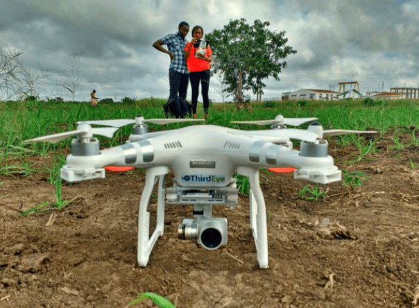
A drone service providing real-time information regarding optimal resource management in agriculture.
ThirdEye is an information service designed to provide farmers with information regarding the state of the field and crops. It enables the optimization of agricultural resources, such as water, seeds, fertilizer, or labor.
ThirdEye uses a drone equipped with a camera and NDVI technology, allowing to process field images and detect crop stress up to 10 days in advance thus helping to decide where and when to allocate limited resources. It provides real-time outputs that can be seen, in the field, with a tablet, monitoring of land use, channels, and river-beds.
Target SDGs
SDG 8: Decent Work and Economic Growth
SDG 11: Sustainable Cities and Communities
Target Users (Target Impact Group)
Household
Distributors / Implementing Organizations
In Mozambique, ThirdEye was developed and launched with the support of USAID, Sida and the Dutch Government of Foreign Affairs. In Kenya, the service was implemented with the support from Smart Water for Agriculture program implemented by SNV.
Competitive Landscape
Direct competitors include Agrieye, SenseFly, and AgEagle RX40.
Countries
Kenya, Mozambique
Manufacturing/Building Method
Unknown
Intellectural Property Type
Trademark
User Provision Model
ThirdEye provides the user with the drone service.
Distributions to Date Status
In Mozambique, there are six ThirdEye operators on the field. Service is provided to over 3500 farmers, covering more than 1600 ha.
In Kenya, training has been given to five operators, who will be serving 2000 small-scale farmers.
Geocoding supported (Y/N)
Yes
Visuals
High resolution image and crop stress analysis
Application
Crop analysis and precision farming
Type of data collected
Infrared aerial images
Data acquisition methods
Field and crop data
Open source code (Y/N)
No
Open source data (Y /N/ Other)
No
Data import/export formats
The service provides aerial crop stress images
Telecommunication service required (Y/N)
No
Device(s) required
Tablet
Languages available (list)
English and Portuguese
Design Specifications
ThirdEye uses the camera to measure the reflection of near-infrared light and blue light, allowing the use of the Normalized Difference Vegetation Index (NDVI).
The drone flies at a height of 100 meters, saving photographic images every five seconds. To cover an area of 100 meters, the device takes approximately 500 images.
Technical Support
In Mozambique, there are six ThirdEye operators on the field.
In Kenya, training has been given to five operators.
Replacement Components
N/A
Lifecycle
N/A
Manufacturer Specified Performance Parameters
Provide adequate information, in real-time and at accurate position, assisting farmers in decision making concerning the optimal application of limited resources such as water, seeds, fertilizer and labor.
Vetted Performance Status
• More than 3,500 farmers have used the service (71% are female) • Water productivity is said to have increased by 55%
Safety
No known safety hazards related to this product.
Complementary Technical Systems
Drone technology
Academic Research and References
“ThirdEye Flying Sensors – Flying Sensors to Support Farmers’ Decision Making.” n.d. Thirdeyewater.Com. Accessed June 12, 2024. http://www.thirdeyewater.com/#
“Goal 8.” n.d. Sdgs.Un.Org. Accessed June 12, 2024. https://sdgs.un.org/goals/goal8
“Goal 11.” n.d. Sdgs.Un.Org. Accessed June 12, 2024. https://sdgs.un.org/goals/goal11
“Goal 15.” n.d. Sdgs.Un.Org. Accessed June 12, 2024. https://sdgs.un.org/goals/goal15
“ThirdEye Flying Sensors – Flying Sensors to Support Farmers’ Decision Making.” n.d. Thirdeyewater.Com. Accessed June 12, 2024. http://www.thirdeyewater.com/#panel1
Advisory, In-Field. n.d. “Our Service Improves Farm Management Decisions, Giving.” Futurewater.Nl. Accessed June 12, 2024. https://www.futurewater.nl/wp-content/uploads/2016/05/Flyer.pdf
Eye, 1. 1. Background. n.d. “Scan This to Watch Our Video:” Futurewater.Nl. Accessed June 12, 2024. https://www.futurewater.nl/wp-content/uploads/2016/06/DescriptionThirdEyeTechnology.pdf
Third Eye project team. n.d. “ThirdEye Featured in USAID Water Report.” Thirdeyewater.Com. Accessed June 12, 2024. http://www.thirdeyewater.com/mozambique-south/thirdeye-project-featured-in-usaid-water-sector-activities-report/
Third Eye project team. n.d. “FutureWater and HiView Give Lectures on the Use of Flying Sensors.” Thirdeyewater.Com. Accessed June 12, 2024. http://www.thirdeyewater.com/the-netherlands/futurewater-hiview-give-lectures-use-flying-sensors/
Compliance with regulations
None
Evaluation methods
NDVI technology allows the drone to analyze in real-time the state of the crops, thus providing farmers with the information needed to evaluate their resource use.
Furthermore, over 3,500 farmers have used the service (71% female), in Mozambique and water productivity is said to have increased by 55%, resulting in more crop per drop. To measure the performance, groups of smallholder farmers were surveyed in areas where ThirdEye is active and where it is not (used as control group to correct water productivity results). Groups were questioned about changes in crop production and water usage, between the previous and current years, allowing to evaluate changes in water productivity.
Other Information
None
Agriculture
June 3, 2024
Implemented by
Occam Technologies Inc
Agriculture
June 22, 2024
Implemented by
Craft Silicon Ltd
Agriculture
February 21, 2024
Implemented by
Habitat for Humanity Haiti

Agriculture
June 27, 2024
Implemented by
Glovo
Agriculture
June 29, 2024
Implemented by
eBee Africa
Agriculture
January 24, 2024
Implemented by
Bornay
Agriculture
February 27, 2024
Implemented by
California Institute of Earth Architecture (CalEarth)

Agriculture
June 23, 2024
Implemented by
Code for America
Agriculture
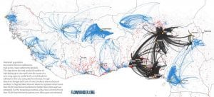
June 20, 2024
Implemented by
Flowminder
Agriculture
December 7, 2024
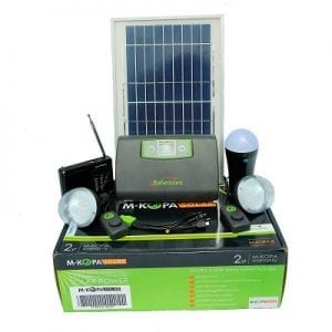
Implemented by
M-KOPA
Have thoughts on how we can improve?
Give Us Feedback